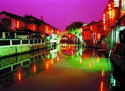
Water Resources

Dotted with many
rivers and lakes, the Shanghai area is known for its rich water resources, with
the water area totaling 697 square kilometers and accounting for 11% of the
city's total territory. Most of the rivers, including the Suzhou Creek,
Chuanyang
River and Diangpu
River, are tributaries of the Huangpu
River. Originated
from the Taihu Lake, the 113-kilometer-long Huangpu River winds through the
downtown area of the city. The river is about 300 to 770 meters wide with an
average width standing at 360 meters. The ice-free Huangpu River is the main
waterway in the Shanghai area. The Shanghai section of the Suzhou Creek runs 54
kilometers, with an average width of 45 meters. The city's lakes assemble mainly
in the western area bordering Zhejiang and
Jiangsu provinces,
with the 62-square-kilometer Dianshan lake being the
largest.
Land Area
The city covered an area of only 636.18 square
kilometers in 1949. By the year 1958, after Shanghai took over 10 counties from
Jiangsu Province -- including Jiading, Baoshan, Shanghai, Songjiang, Jinshan,
Chuansha, Nanhui, Fengxian, Qingpu and Chongming, the area under the city's
jurisdiction expanded to 5,910 square kilometers. The city had a total area of
6,340.5 square kilometers at the end of 2002, 0.06% of China's total territory.
Shanghai extends about 120 kilometers in north and south and nearly 100
kilometers in east and west. The city's 19 districts cover a total area of
5,299.29 square kilometers and its only county has an area of 1,041.21 square
kilometers. The city has three islands -- Chongming, Changxing and Hengsha --
under its jurisdiction and Chongming Island is the third largest island in
China, covering an area of 1,041.21 square kilometers.
Climate
With a pleasant northern subtropical maritime monsoon
climate, Shanghai enjoys four distinct seasons, generous sunshine and abundant
rainfall every year. Its spring and autumn are relatively short comparing with
the summer and winter. In 2002, the average annual temperature was 17.8 degrees
Celsius. The city had a total sunshine time of 1,686.5 hours in 2002 and
received an annual rainfall of 1,427.9 millimeters. However, about 60% of the
precipitation came during the May-September flood season, which is divided into
three rainy periods, namely, the Spring Rain, the Plum Rain and the Autumn
Rain.
Geographic Location
Shanghai is situated at 31'14' north latitude and
121'29' east longitude. Bordering on Jiangsu and Zhejiang Provinces on the west,
Shanghai is washed by the East China Sea on the east and Hangzhou Bay on the
south. North of the city, the Yangtze River pours into the East China Sea. It
also assumes the central location along China's coastal line. Thanks to its
advantageous geographic location, Shanghai has today become an excellent sea and
river port, boasting easy accesses to a vast hinterland.
Shanghai's Location in the World Map and Its Main
Transportation Network
ap of Shanghai
China
Shanghai Huangpu
District Luwan
District
Xuhui District Changning District Jing'an District Putuo District
Zhabei District Hongkou District Yangpu District Minhang District
Baoshan District Jiading District Jinshan District Songjiang District Pudong District Qingpu District Nanhui
District
Fengxian District Chongming
County


