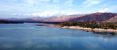
It is commonly considered that the Yellow River can be divided into the three following reaches.
The upper reaches of the yellow river is referred to the area above the Hekou Town in Tuoketuo County, Inner Mongolia Autonomous Region. The river in this section goes rushing and carries for nearly 50 percent of water resource of Yellow river.
The middle reaches runs from Hekou Town to Tao Huayu in Zhengzhou, Henan Province. The river passes through the longest series of continuous valleys on its main course, collectively called the Jinshan Valley. The large amount of mud and sand discharged into the river makes the Yellow River the most sediment-laden river in the world. And the abundant hydrodynamic resources stored in this section make it the second most suitable area to build hydroelectric power plants.
The lower reaches of the Yellow River is recognized as the area below Tao Huayu in Zhengzhou.